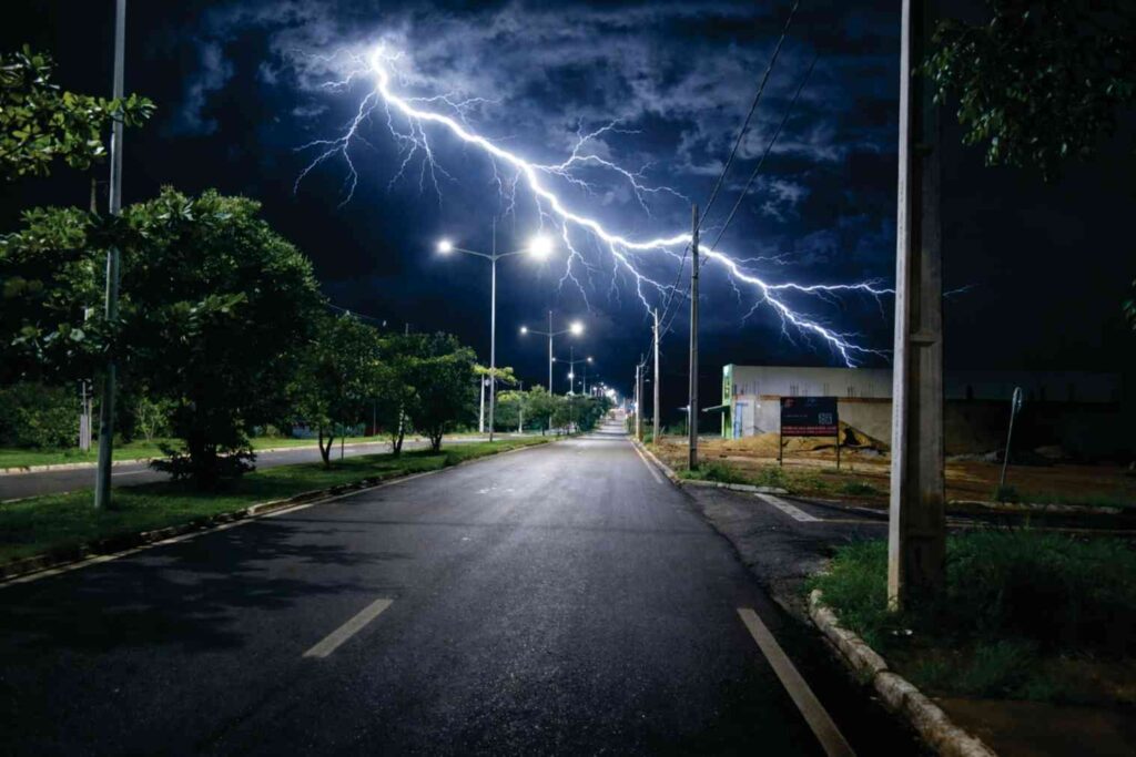
Lightning, one of nature’s most spectacular and dangerous atmospheric phenomena, has fascinated and terrified humanity for millennia. Historically viewed as a divine sign from the gods, modern science now understands lightning as a massive electrostatic discharge between electrically charged regions within a cloud or between a cloud and the Earth’s surface. In the realm of physical geography and meteorology, the ability to track these sudden bursts of energy in real-time has revolutionized our understanding of storm dynamics and public safety. Lightning strike maps, powered by intricate global detection networks, provide a visual representation of where and when lightning occurs, allowing scientists to monitor weather patterns with unprecedented precision. These maps are not just dots on a screen; they are the result of complex geographical sensors working in perfect synchronization across continents and oceans. By analyzing the frequency and distribution of strikes, we gain critical insights into the Earth’s electrical circuit and the changing intensity of regional climates. Exploring the technology behind these maps reveals a world where high-speed sensors and satellite data merge to decode the erratic behavior of the skies, providing a vital tool for aviation, agriculture, and emergency management in our increasingly volatile environment.
The Mechanics of Lightning Detection Networks To understand a lightning map, one must first understand the “Earth Networks” or “Global Lightning Dataset” that feeds it. When a lightning bolt strikes, it emits a wide spectrum of electromagnetic radiation, ranging from visible light to radio waves. Specialized ground-based sensors, strategically placed across various geographical locations, are designed to detect these radio frequency pulses, specifically in the Very Low Frequency (VLF) and Low Frequency (LF) bands. These sensors record the exact microsecond the signal arrives. By using a process called “Time of Arrival” (TOA) and magnetic direction finding, a central processor can triangulate the precise latitude and longitude of the strike. The speed of light allows this data to be processed and displayed on a digital map within seconds. This geographical distribution of sensors ensures that even remote areas, where traditional radar might fail, are covered by the electrical eyes of the network.
Geographical Hotspots: Where Lightning Strikes Most Lightning strike maps have allowed geographers to identify “lightning chimneys”—specific areas on Earth where lightning is exceptionally frequent. Geography plays a massive role in this distribution. For instance, the Lake Maracaibo region in Venezuela holds the world record for lightning frequency, largely due to its unique topography where mountain breezes meet warm, moist air over the lake. Similarly, Central Africa and parts of the Himalayas are hotspots where rising heat and mountainous terrain create the perfect conditions for deep convection. Conversely, lightning is rare over the open oceans compared to landmasses because land surfaces heat up faster, driving the updrafts necessary for storm formation. By studying these maps over decades, scientists can observe how shifts in global temperatures are moving these hotspots, providing a direct link between atmospheric electricity and long-term climate geography.
Interpreting the Data: What the Colors and Dots Mean When viewing a modern lightning map, the data is often categorized by color and symbol to provide a narrative of the storm’s life cycle. Typically, “In-cloud” (IC) lightning is distinguished from “Cloud-to-Ground” (CG) strikes. IC lightning often serves as a precursor to severe weather, including tornadoes and hail, making its detection crucial for early warning systems. On a map, you will often see a progression of colors—for example, white dots for the most recent strikes (within minutes), fading into yellow, orange, and red as the strikes get older. This color-coded geography allows meteorologists to see the direction and speed at which a storm cell is moving. It also reveals the “lightning density,” which helps utility companies identify which parts of a power grid are at the highest risk of a surge or blackout during a passing front.
The Role of Satellite Technology in Global Mapping While ground sensors are excellent for precision, satellite-based detection has filled the geographical gaps over the vast oceans and uninhabited deserts. Instruments like the Geostationary Lightning Mapper (GLM) aboard modern weather satellites provide a continuous, “big picture” view of lightning activity across entire hemispheres. Unlike ground sensors that detect radio waves, these satellites use high-speed cameras to detect the momentary changes in optical brightness at the top of clouds. This satellite data is integrated with ground-based maps to create a seamless global view. For pilots navigating transoceanic flights, this integrated geography is a lifeline, allowing them to steer clear of massive, electrically active storm systems that are invisible to standard aircraft radar.
Societal Impact and Safety Applications The practical application of lightning mapping technology is vast. In the agricultural sector, farmers use these maps to protect livestock and sensitive equipment. In the forestry department, “dry lightning” (lightning that occurs without rain) is a primary cause of wildfires; real-time maps allow fire crews to pinpoint exactly where a strike occurred in a dense forest, even before smoke is visible. Furthermore, for outdoor sporting events and airports, the “30-30 rule” (if you see lightning and hear thunder within 30 seconds, seek shelter) has been augmented by digital alerts that notify officials when a strike occurs within a 10-mile radius. This geographical precision has significantly reduced the number of lightning-related fatalities worldwide, proving that the marriage of technology and geography is a powerful force for public good.
Conclusion: The Future of Atmospheric Monitoring As our planet’s climate continues to evolve, the geography of lightning will likely shift, with more frequent and intense storms appearing in previously stable regions. Lightning strike maps will remain our primary window into this change, acting as both a real-time safety shield and a long-term scientific record. The evolution of these maps—from simple plots to high-definition, multi-layered digital twins of the atmosphere—reflects our growing ability to monitor the Earth’s most chaotic elements. By continuing to refine these detection networks, we not only protect our modern infrastructure but also deepen our respect for the raw, untamed power of the natural world. The “Thunder Maps” of the future will undoubtedly offer even greater clarity, ensuring that as long as the skies continue to crackle with energy, we will be watching, mapping, and learning from every strike.